
About The Atlas of Canada
The Sixth Edition was launched on the Internet, being one of the first electronic online atlases in the World. Each edition documents Canada’s ever changing landscape and its diverse population through maps, charts, tables and analytical texts. With Canadian economic and demographic conditions becoming more and more complex, there has developed a national need to broaden our knowledge of the geography of Canada. An expanding desire to have more access to information has further fuelled the present evolution of the Atlas of Canada. The most recent edition represents a departure from the paper map to a dynamic collection of interactive maps, graphics, images and multi-media resources.
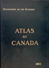
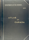
In the period from 1906 to 1915, when the First and Second editions of the Atlas of Canada were published by the Department of the Interior, Canada was a nation of some seven million inhabitants of which only 30% lived in the fifteen towns and cities with populations over 25 000.
At that time, Canada had an economy based largely on agriculture, minerals and forest products. This meant that national economic well-being depended very much on the existence and development of an adequate transportation system, as well as on the development of new resources. During this period, a major part of Canada's growth was due to the great influx of immigrants into Canada, many of them coming to open up the farmlands of the Prairies. Consequently, the first two editions of the Atlas of Canada reflect a particular interest in transportation and communications and devote a significant amount of space to mapping the composition and density of the population.
Between the World Wars, some government agencies continued publishing small-scale thematic maps similar to those which would have been required for a national atlas. However, there was no concerted attempt to bring these separate and uncoordinated efforts together. The diminished level of government activities during the Great Depression also postponed any further work on a coordinated national atlas.
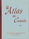
Following the Second World War, however, more attention began to be paid to the lack of available geographical information, particularly for the northern areas of Canada. There was also a greater recognition of the value of such intelligence as a basis for public awareness and sound national planning. As a result, the Third Edition of the Atlas of Canada was started in the early 1950s. By 1958, when it was published, the population of Canada had grown to 17 million, new mineral resources were being tapped and striking progress had taken place in Canada's industrial and urban development.
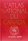
In the following years, more geographical information became available for areas throughout Canada. As well, almost every field of national interest presented new problems and challenges, some of global importance. These pointed to the need for summaries of spatial information on environmental and socio-economic subjects. In response to this, the Fourth Edition was published in 1974. There was a name change with this edition to "The National Atlas of Canada". The experiences in issuing the fourth edition as folio sets of maps before a bound volume was published led to a reappraisal of national geographical information needs. As a result, the concept of a continuing National Atlas program was officially adopted and supported.
The Fifth Edition, completed in 1993, was comprised of 93 maps available in both French and English versions. Maps were presented at a larger scale than previous editions (primarily 1:7 500 000) and, for the first time, digital cartography and remotely-sensed data from satellite images were used. The completion of this latest edition offered the opportunity to explore the developing technologies to seek the most efficient way to portray spatial information about Canada in a cost- effective manner so that it would reach the widest possible audience. At the same time, the popularity of the Internet was beginning to explode and through the enthusiasm of several people at the National Atlas Information Service, the idea of putting the National Atlas on the Internet was born.

Following the release of the Fifth Edition, the National Atlas staff started to explore new ways to deliver geographical information, at a national scale, to a broader audience. The World Wide Web became the primary focus for disseminating new national maps. The original version of The National Atlas on the Internet was launched in 1994. The initial success of interactive mapping led to further work by the Atlas with Industry Canada for the creation of geography content for SchoolNet. This work expanded the Atlas content from a few small holdings to the hundreds of maps and thematic layers that exist today.
Content and information access tools were developed in consultation with the educational community through a Teacher Advisory Group, representing teachers from across Canada. The Web site contained a quiz about the geography of Canada, a resource section for teachers, and textual background information on the maps. Many of the suggestions made by the Teacher Advisory Group were put into place before the site was launched.
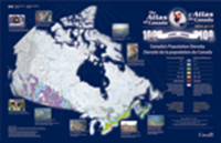
Another project, the result of a joint effort between the Royal Canadian Geographical Society and the National Atlas of Canada, resulted in the creation of poster-maps that explained national concerns. The poster-map format used a mix of maps, images and texts. These same maps were then distributed through the Canadian Geographic magazine.
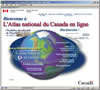
In 1998, the Government of Canada authorized an ongoing program for an Internet-based National Atlas. This led to the launch of the sixth edition, The National Atlas of Canada Online, at the International Cartographic Association conference in Ottawa, August 1999. This new edition offered the very latest interactive mapping technology on the Internet. Users can browse interpreted information to better understand the geography of Canada. They can interact with the data being made available through the Atlas and can access the sources of data.
Since the official launch of the Sixth Edition, the online Atlas has seen many revisions, mostly in response to the needs of the user audience. With each technological advance, and content addition, the Atlas team has conducted user-centred requirements studies, engaged focus groups and captured feedback through various online surveys, interviews and usability analyses.
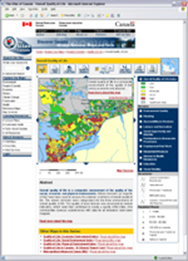
The needs of atlas users vary broadly from basic locational reference to in depth research on topics such as Climate Change. Interactive mapping and visualization allows for research at various map scales, where varying degrees of thematic detail are delivered. Comprehensive texts and related links drive the research process even further. Online Atlas content has been organized to allow users to select and pursue their areas of interest, quickly and easily. The Reference Map Series is an example.
In addition to the online Atlas, paper maps are published regularly as a series of poster maps and wall maps, depicting Canada, North America and the world.
In April 2002, the name of the Atlas site changed from The National Atlas of Canada back to its original, The Atlas of Canada, as part of a major revision to the Web site.
Page details
- Date modified: