
Data Integration and Analysis
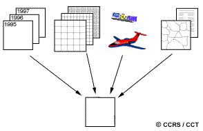
In the early days of analog remote sensing when the only remote sensing data source was aerial photography, the capability for integration of data from different sources was limited. Today, with most data available in digital format from a wide array of sensors, data integration is a common method used for interpretation and analysis. Data integration fundamentally involves the combining or merging of data from multiple sources in an effort to extract better and/or more information. This may include data that are multitemporal, multiresolution, multisensor, or multi-data type in nature.
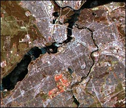 Multitemporal data integration has already been alluded to in section 4.6 when we discussed image subtraction. Imagery collected at different times is integrated to identify areas of change. Multitemporal change detection can be achieved through simple methods such as these, or by other more complex approaches such as multiple classification comparisons or classifications using integrated multitemporal data sets. Multiresolution data merging is useful for a variety of applications. The merging of data of a higher spatial resolution with data of lower resolution can significantly sharpen the spatial detail in an image and enhance the discrimination of features. SPOT data are well suited to this approach as the 10 metre panchromatic data can be easily merged with the 20 metre multispectral data. Additionally, the multispectral data serve to retain good spectral resolution while the panchromatic data provide the improved spatial resolution.
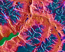 Data from different sensors may also be merged, bringing in the concept of multisensor data fusion. An excellent example of this technique is the combination of multispectral optical data with radar imagery. These two diverse spectral representations of the surface can provide complementary information. The optical data provide detailed spectral information useful for discriminating between surface cover types, while the radar imagery highlights the structural detail in the image.
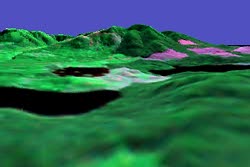 Applications of multisensor data integration generally require that the data be geometrically registered, either to each other or to a common geographic coordinate system or map base. This also allows other ancillary (supplementary) data sources to be integrated with the remote sensing data. For example, elevation data in digital form, called Digital Elevation or Digital Terrain Models (DEMs/DTMs), may be combined with remote sensing data for a variety of purposes. DEMs/DTMs may be useful in image classification, as effects due to terrain and slope variability can be corrected, potentially increasing the accuracy of the resultant classification. DEMs/DTMs are also useful for generating three-dimensional perspective views by draping remote sensing imagery over the elevation data, enhancing visualization of the area imaged.
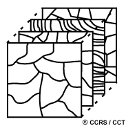 Combining data of different types and from different sources, such as we have described above, is the pinnacle of data integration and analysis. In a digital environment where all the data sources are geometrically registered to a common geographic base, the potential for information extraction is extremely wide. This is the concept for analysis within a digital Geographical Information System (GIS) database. Any data source which can be referenced spatially can be used in this type of environment. A DEM/DTM is just one example of this kind of data. Other examples could include digital maps of soil type, land cover classes, forest species, road networks, and many others, depending on the application. The results from a classification of a remote sensing data set in map format, could also be used in a GIS as another data source to update existing map data. In essence, by analyzing diverse data sets together, it is possible to extract better and more accurate information in a synergistic manner than by using a single data source alone. There are a myriad of potential applications and analyses possible for many applications. In the next and final chapter, we will look at examples of various applications of remote sensing data, many involving the integration of data from different sources.
Page details
- Date modified: