
Navigating a ship through ice
Introduction
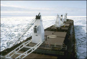
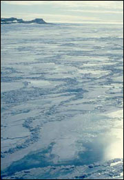
In Canada's ice-infested waters, ship captains have to pay careful attention to where, how much and what type of ice is in front of them. Going the wrong way can waste fuel, slow the ship down and be dangerous if the ship gets damaged or gets stuck in the ice. Satellite images can give a large view of the area in front of a ship and will allow an experienced interpreter to estimate the age, type and concentration of the ice. With radar sensors, images can be acquired through clouds and even at night! The images are sent to the ship by communications satellites, so the captain can see the most recent ice conditions in front of his ship.
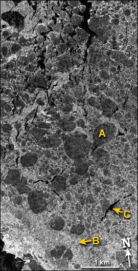
The image in this activity shows a radar image of ocean ice, from Canada's RADARSAT satellite. An example of a first year ice floe is shown at "A". Broken ice fragments, called "brash ice", such as at "B", fill much of the space between the floes. A crack in the ice, exposing the open water surface is called a "lead" and one example is shown at "C".
A ship captain would want to navigate through leads as much as possible, since there is no ice resistance to his ship's travel. He would also want to avoid ice floes, since the brash ice is easier for the ship to push through.
Task
Starting at (3.0, 0.0) and ending up at (0.5, 9.5), find the best passage for a ship. Use leads, wherever possible, and avoid ice floes. Measure the distance over the route that you've chosen.
That distance is:
_________________km.
Hint: It should be less than 10 km.
Radar image legend
- Ice floe (solid ice)
- Brash ice (ice fragments)
- Lead (open water)
Page details
- Date modified: