
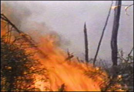
Forest fire
Introduction
 There are many forest fires in Canada every year. The ones in the northern parts of Canada are difficult and expensive to fight, because it's complicated to get people and supplies quickly to those isolated areas, and there are probably no airports or roads. Satellite images can be used to map the types of vegetation, sources of water and areas that are difficult to travel over, like swamps.
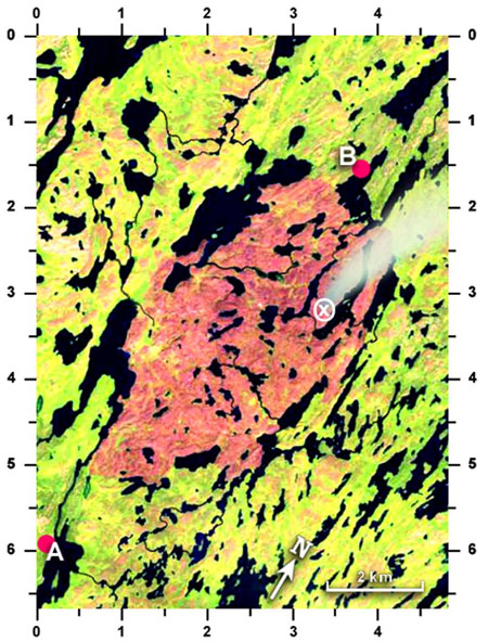
In this satellite image, the yellow and green colours show unburned forest and other vegetation types. The red/orange colour is a recently burnt area. The black shapes are lakes and rivers. The small pink areas around the burn are unvegetated areas where rock shows through the soil. Notice that the fire was stopped mostly by reaching the edge of a river or lake. At other points, it probably stopped because of swamps or bare ground or because the wind reversed direction.
The main camp for firefighting in this area is at location "A". A smaller advance camp has been set up at "B", because there is a good chance that the fire will flare up again and the wind will push it to the north. We need to send people, equipment and supplies by boat to the advance camp from the main camp.
Find the shortest route by water from "A" to "B". Measure this distance, using string (or a shoelace).
That distance is: ______________ km.
A fire has flared up at "X". We can use firebombers (airplanes that drop water) to try to douse it. The planes need 2km of straight-line distance over water to safely collect a full tank of water. To which lake would you send them?
The middle of the lake that is closest for such a purpose is at: (____, ____).
The middle of the next closest lake would be at: (____, ____).
Page details
- Date modified: