
Landslides
Terrestrial landslides represent a constant and ubiquitous threat to the well-being of Canadians, accounting for an estimated $200 to $400 million in direct and indirect costs annually. A landslide is any type of slope failure or downward movement of rock and/or sediment. The flow volumes of such events can range from a few cubic meters to more than 10 km3 and the rates of movement can range from virtually imperceptible to greater than 100 km/hour. Excessive rainfall, earthquakes and certain human activities are some of the factors that commonly trigger landslides. Thousands of landslides occur each year across Canada.
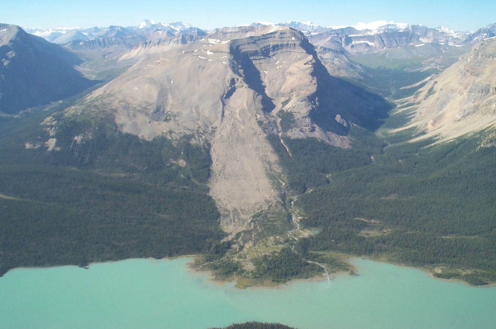
Brazeau Lake, Alberta rock slide, photo by S.G. Evans (GSC).
Landslides pose a significant threat to humans (loss of life), infrastructure (destruction of roads, communication networks, pipelines, homes, etc.) and natural resources (timber, fisheries, mines). NRCan scientists regularly work with industry, academia and other government agencies to provide critical scientific knowledge and related information to help guide others (e.g. planners, geotechnical consultants, etc.) in the management of landslide hazards.
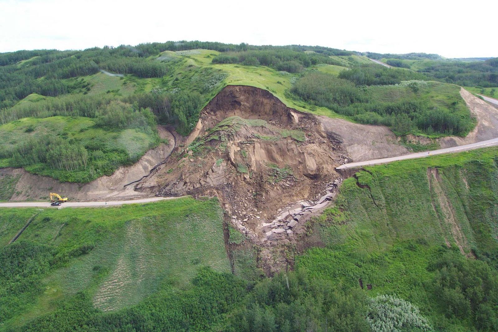
Cecil Lake road landslide, Peace River, photo by R. Couture (GSC).
NRCan specialists engage in a variety of activities aimed to enhance the health and safety of Canadians and to protect their property from landslide hazards. From basic data collection to the testing of new landslide monitoring technologies, including satellite Earth Observation data, and the development and provision of technical guidelines for professional practitioners, the collective focus of NRCan specialists is to minimize human and material losses associated with landslide geohazards.
Publications
Sample publications
- Map of historical landslides that have caused deaths (1771-2015)
- Canadian technical guidelines and best practices related to landslides: a national initiative for loss reduction
- Landslide susceptibility map of Canada
- Characterizing and monitoring rockslides from SAR techniques
Publications categories
Publications search
Use your own search criteria to discover more scientific publications.
Data Collections
Retrieve data related to:
or search the entire collection of geospatial data, topographic and geoscience maps, images and scientific publications.
Atlas of Canada Maps
Browse the following selected maps from the Atlas of Canada:
- Natural Hazards (including Major Landslides Causing Fatalities)
or explore other popular maps featured in the Atlas of Canada
Tools and Applications
Page details
- Date modified: