
Le Goulet’s Climate Change Adaptation Plan
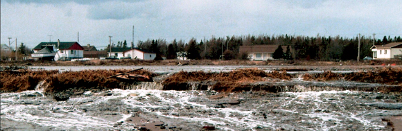
Photo courtesy of Le Goulet
PLANNED RELOCATION AS AN OPTION TO ADDRESS SEA-LEVEL RISE
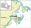
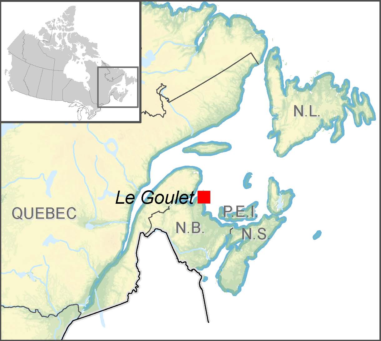
Le Goulet is a small fishing community with a population of 950 located on the Acadian Peninsula in northeast New Brunswick. The village is low-lying and relatively flat, two features that make it particularly vulnerable to the impacts of a changing climate and rising sea levels.
Local residents have noticed an increase in the frequency and intensity of extreme weather, including storm surges and flooding, and are worried about future impacts on their homes and livelihoods. For example, in the last 15 years, four major floods resulting from coastal storm surges have affected up to 30 homes in the village. These floods contaminated drinking water supplies (salt-water intrusion), caused septic tanks to overflow and flooded access roads, hampering emergency procedures. Contaminated drinking water and mould issues continue to be problems for many homes.
Le Goulet is separated from the Gulf of Saint Lawrence by sand dunes and salt marshes, both of which act as important natural buffers from storm events. Human extraction of dune sand in the 1980s (now illegal), combined with greater-than-normal coastal erosion rates (associated with reduced winter ice cover) and the four major storm surge events have resulted in erosion of the dune sand from a maximum height of 2 m above sea level to a height of just half a metre today. The lower dune levels leave residents increasingly concerned about the impact of future storm surges.
Three principal coastal adaptation methods
Retreat – Relocate human settlement (homes, roads, etc.) away from areas of potential flooding, allowing the rising sea to advance inland.
Accommodate – Engage in actions that compensate for climate-related changes (e.g. constructing raised homes on pilings to accommodate rising sea levels).
Protect – Safeguard existing coastal land uses by implementing measures such as sea walls, dikes, beach nourishment and wetland restoration.
In 2002, engineering consultants hired by the village recommended that a 3.8-km sea wall be constructed just seaward of the sand dunes to protect against the worst impacts of storm surges, at an estimated cost of $3.3 million. In 2004, community leaders asked University of Moncton climate change specialists to assist the village in producing a comprehensive local plan to adapt to the impacts of climate change and rising sea levels. The development of the plan included three phases.
Phase I – Raising awareness
In 2007, climate change specialists made three presentations in Le Goulet on different aspects of climate change, storm surges and coastal erosion. The presentations provided local residents with a sound scientific base from which to make informed adaptation and planning decisions. Three principal coastal adaptation methods were presented: retreat, accommodate and protect.
Phase II – Focus groups
Researchers organized discussion groups with 10 to 12 interested residents, living both inside and outside the at-risk zone, and local leaders (including the mayor and councillors). The goal of these group discussions was to arrive at adaptation options to be included in the draft plan. This collaborative exercise led to, among other things, public consensus on the geographic definition of the area at risk.
Phase III – Adaptation options
The discussion groups decided on two principal adaptation options:
Option A: The voluntary retreat of homes most at risk
It was decided that relocating homes at risk from flooding (retreat) to a higher elevation is the most desirable and cost-effective means to reduce the multiple health and safety issues stemming from storm surge flooding. While the retreat option received consensus support within the discussion groups, it remains controversial for many villagers.
For example, the logistics of relocation would be complicated, as funds would have to be made available to compensate for relocation costs and help persuade residents to make the move. Option A also includes sand dune restoration efforts, and modification of the municipal zoning bylaw to ensure only approved adaptive development occurs in flood-prone areas.
Option B: The construction of a 3.8-km sea wall
For some residents, the construction of a sea wall is the most viable option for protecting the community from storm surges and flooding. However, during the group discussions, residents raised doubts as to the efficacy of the sea wall in preventing flooding and contamination of drinking water wells for low-lying homes. If a sea wall cannot prevent these risks, an expensive municipal water and sewage system (estimated at $14 million) would have to be constructed to provide safe drinking water and sewage disposal.
Innovative zoning bylaw
Rather than prohibiting all development projects in flood-prone areas of Le Goulet, the local planning commission took a more targeted approach. Using results from the discussion groups, the commission identified a zone where climate change impacts are considered a major risk that developers must consider in their plans. The zoning bylaw provides an opportunity to educate developers about the climate change related risks to people and infrastructure, and ensures that appropriate, but not prescriptive, measures are taken to accommodate those risks. The commission is working with the New Brunswick Department of Environment to develop criteria for adaptation that developers should consider when presenting a development proposal.
The group discussions identified several important studies to conduct before moving forward with either option: (1) the development of a digital risk map that superimposes various climate change scenarios (flooding and erosion) with existing topographical features and infrastructure; (2) a modelling study of the impacts of a sea wall on coastal erosion and salt-water intrusion; and (3) a detailed cost analysis for the various adaptation measures.
The university-community partnership successfully initiated an important debate about the future of the community and spurred the following actions. First, in 2009 the Commission d’aménagement de la Péninsule acadienne (local planning commission) modified the village’s zoning bylaw to prevent unsuitable development in flood-prone areas. Second, New Brunswick’s Department of Natural Resources agreed to produce a high-resolution digital elevation map of the coastline, information needed to inform all possible adaptation options. Data collection for the map took place in the summer of 2010.
Many small communities lack the resources to develop and implement a comprehensive climate change adaptation plan. In Le Goulet, policy-makers were able to rely on nearby researchers from the University of Moncton to provide impartial impacts and adaptation information, to facilitate a discussion process and to draft a plan based on the outcomes from the discussions. This example demonstrates the importance of collaboration between local residents and climate change specialists when producing a climate change adaptation plan for a small community.
Contact:
Benjamin Kocyla Directeur – Conseiller en urbanisme Commission d’aménagement de la Péninsule acadienne Tel.: 506-727-7979 E-mail: benjaminkocyla@nb.aibn.com
Page details
- Date modified: