
Preparing for Storm Surges in Annapolis Royal, Nova Scotia
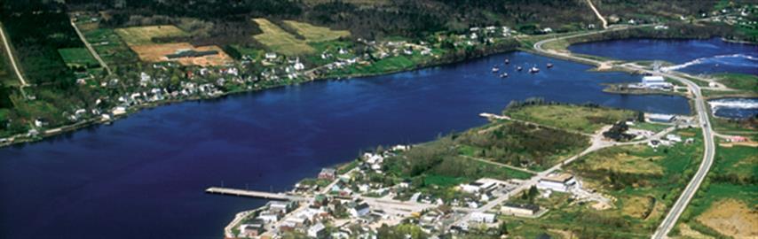
Photo courtesy of Paul Illsley
SMALL COMMUNITIES CAN TAKE PRACTICAL STEPS TO REDUCE THEIR CLIMATE VULNERABILITY
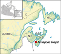
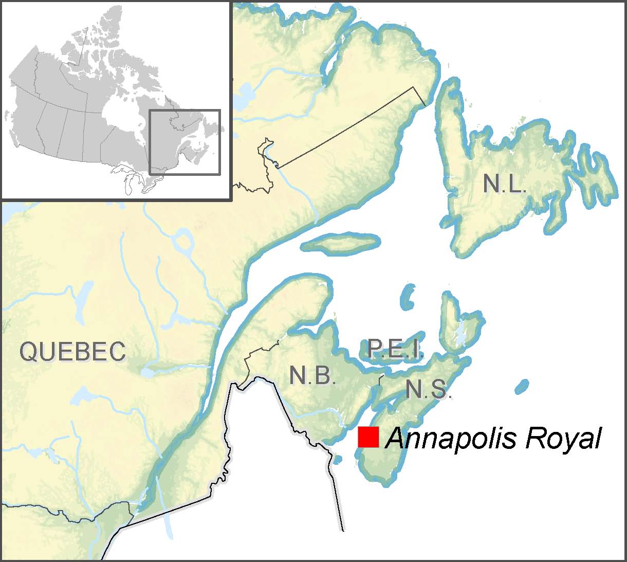
Annapolis Royal, Nova Scotia, is a coastal community with a population of approximately 500 located on the southern shore of the Bay of Fundy. A significant area of the town is low-lying, an attribute that, along with rising sea levels and the fact that land has been sinking for thousands of years, makes it increasingly vulnerable to flooding.
Finding critical data with limited resources
The Clean Annapolis River Project (CARP) searched records from museums, newspapers and historical societies to discover the types of events that occurred in the past and to estimate changes in climatic and tidal factors. The most severe event, the Saxby Gale of October 4–5, 1869, was used as a model for flood predictions.Finding precise terrain elevation data was also crucial to the Tidal Surge Project. The standard contour interval in the 1:10 000 digital maps is 5 m. This is insufficient when a few centimetres can be the difference between a disastrous flood and a non-event. Instead, CARP obtained paper maps from 1980 at a 1:2000 scale with 2 m contours and spot elevations of 10 cm. With this more detailed information, it was able to determine the locations most at risk from tidal surge flows and the areas most in danger of flooding. Further studies have added yet a higher level of detail (see next inset box).
Climate change will cause coastal communities to experience a rise in sea level and likely increases in the frequency and intensity of storm surges and coastal erosion. Annapolis Royal residents wanted to know whether the risk of flooding would increase in the future and what infrastructure, such as roads, bridges and buildings, would be vulnerable. Of particular concern was the large number of heritage buildings of national significance in the Fundy region.
A citizens-based group, CARP, undertook the Tidal Surge Project in 1998 to assess the town’s vulnerability to storm surges. The goal was to identify and gather information on potential threats, including floods during times of extreme tides and storm surges, so the community could put appropriate emergency-response plans and procedures in place.
CARP discovered that a tidal surge during a severe storm was a rare but real threat to coastal zones in their region, particularly if it occurred concurrently with an unusually high tide (the latter happens several times each year). Using future climate change scenarios and resulting sea-level rise predictions, storm surge floods were mapped. With the information gathered, CARP was able to identify wide potential risk zones for tidal surge flooding and possible implications for people in the region.
Continued improvement: 2008 flooding scenario maps
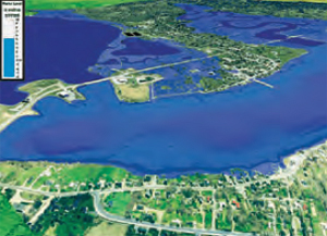
The Groundhog Day storm with 50 years of projected sea-level rise.
To develop improved flooding maps, the Applied Geomatics Research Group conducted a LiDAR survey that used an airborne laser to scan the ground to obtain elevation data to an accuracy of ±15 cm. The team then created flood risk maps with these data, GIS and software developed in-house, called “the Water Modeller.” The 1976 Groundhog Day storm, during which a high tide coincided with a storm surge, was used as benchmark for flooding. An accurate record of water levels achieved during the Groundhog Day storm was obtained from the tide gauge in Saint John, New Brunswick, which lies across the Bay of Fundy from Annapolis Royal. Future sea-level rise from climate change was then incorporated into the risk statistics and the final maps. To calculate sea levels, the following factors were considered:
- projected global sea-level rise – 50 cm in the next century, from the Intergovernmental Panel on Climate Change (2007)
- crustal motion (uplift or subsistence) – The Fundy region of Nova Scotia is sinking at a rate of 20 cm per century.
- tidal range – The Bay of Fundy tidal range is expected to increase by 10 cm over the next century with increasing sea levels.
The resulting flooding maps can be readily updated to reflect improved estimates of global sea-level rise.
The results of the project were presented to citizens in a series of public forums. These were followed in the spring of 1999 by a mock disaster scenario that engaged local fire, medical and emergency response teams. The public was also involved, allowing citizens to observe the potential effects that a flood might have on their lives and enabling them to explore how to minimize property damage and harm during a real disaster.
In response, various adaptive planning measures were taken. These include a renewed focus on the need to both raise and properly maintain dikes, issues which have been acknowledged by the provincial government. The maps revealed that during a major flooding event, the fire hall, which is situated on a small rise, would become an island separated from the rest of the community. Subsequently, the Fire Department acquired a boat and modified its emergency response plans, including the relocation of much of the rescue equipment (previously stored solely at the station). One homeowner particularly at risk decided to raise his home by more than half a metre.
CARP’s original Tidal Surge Project led to an important spinoff. In 2005 a team of scientists from the Applied Geomatics Research Group (AGRG) at the Centre of Geographic Sciences (COGS) in nearby Lawrencetown set out to develop high-resolution maps that more accurately visualize future flooding scenarios for the Fundy region of Nova Scotia. The resulting maps, published in 2008, allow Annapolis Royal and other coastal communities in the region to better plan for the future.
Municipal staff in Annapolis Royal use the AGRG maps to inform potential developers of risks from storm surges. In addition, staff have been actively engaging various stakeholders in the Fundy region to develop a coordinated regional approach to tackling future flooding problems. CARP’s work demonstrates that even with limited resources, communities can reduce the uncertainty of climate change effects and find ways to adapt. Actions taken by the town serve to reduce current vulnerability to storm surge flooding and will continue to be built upon, as estimates of future sea-level rise improve.
Annapolis Royal municipal staff look forward to continuing to work with partners and various stakeholders to place the impacts of climate change, and associated storm surge flooding, higher on the regional agenda.
Contact:
Amery Boyer CAO, Town of Annapolis Royal Tel.: 902-532-3146 E-mail: cao@annapolisroyal.com
Steve Hawboldt Executive Director Clean Annapolis River Project Tel.: 902-532-7533 E-mail: carp@annapolisriver.ca
Page details
- Date modified: