
Question 1
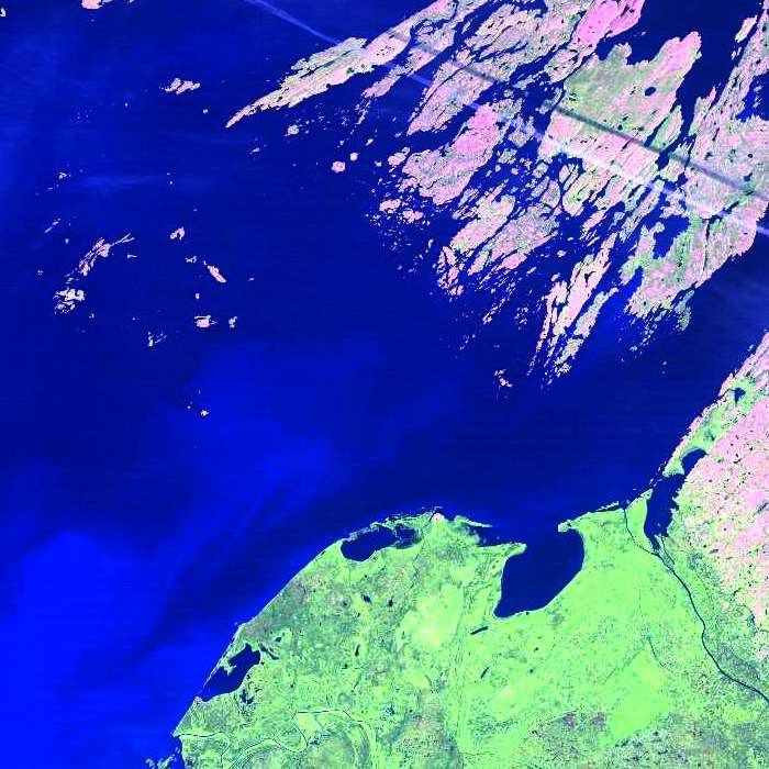
Landsat 5 TM image of the eastern end of Great Slave Lake
Question
This Landsat Thematic Mapper image segment has a
band => colour assignment of:
- R,G,B => 1,2,3
- R,G,B => 2,3,1
- R,G,B => 5,4,3
Choose the band-to-colour assignment (A, B or C, above) that fits this Landsat TM satellite image colour composite.
Did You Know?
Notice the very rough and convoluted shoreline in the pink areas in the top half of the image and how it contrasts with the relatively smooth shoreline in the green areas in the bottom part of the image. This is a sure indication that the rocks of the Canadian shield are exposed in the pink areas, while there is substantial overburden (soil) in the green areas.
Image Information
eastern end of Great Slave Lake, Landsat 5 TM
Page details
- Date modified: