
Watershed Boundaries
National Hydrographic Network (NHN) data is produced and distributed by watershed, also known as NHN Work Units or NHN Index. Each NHN watershed boundary delineates the drainage area covered by an NHN dataset. Watershed boundaries are distributed through NHN data products.
The boundaries of the NHN watersheds are open, free and accessible through the Federal Open Government portal.
- The NHN watershed boundaries are available under "Resources" section within the "Index of available files" in National Hydrographic Network - NHN - GeoBase Series.
- View the NHN interactive map and zoom to the NHN watershed boundary scale.
Facts about Watershed Boundaries
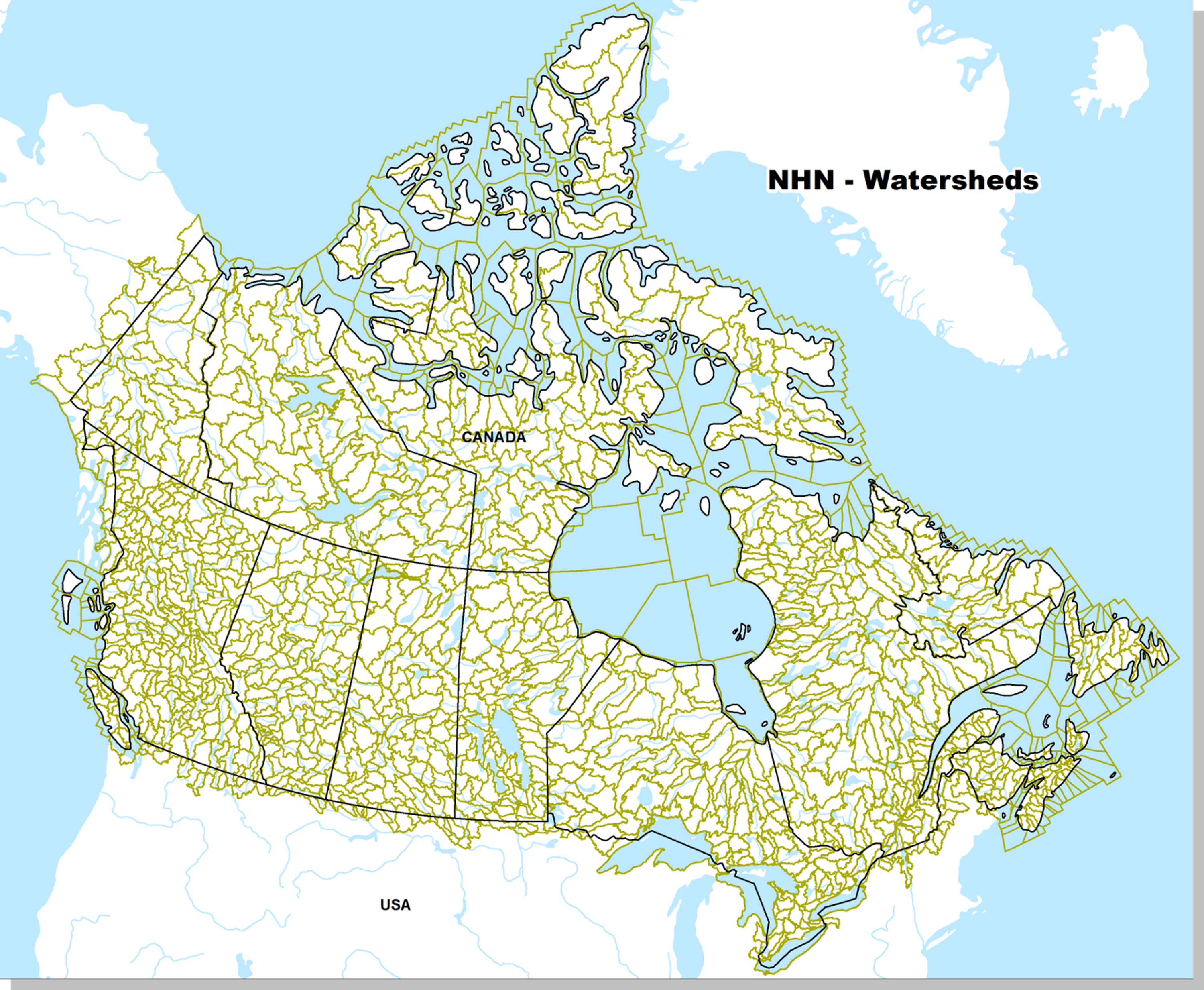
- There are more than 1382 basins covering the entire Canadian landmass.
- Each watershed is a simple polygon without holes.
- The watersheds form a continuous layer.
- The watersheds index is available in Shapefile format (ESRITM) and in kmz format of Google Earth.
Watershed coverage extends from the Canada-U.S. border to the Canadian territorial sea boundary or to the National Topographic System (NTS) 1:50 000 tile boundary along Canada’s coasts.
The NHN watersheds were created from the Water Survey of Canada Sub-Sub-Drainage Area (WSCSSDA) and Fundamental Drainage Areas (FDA) of the Atlas of Canada.
Note that NHN watersheds evolve over time. They are modified and refined when source data is replaced and updated, or when provincial source data is introduced into the data production process as part of NHN partnerships between federal and provincial/territorial agencies. Therefore, they no longer coincide exactly with the boundaries of WSCSSDAs and FDAs, so do not mix them up.
Page details
- Date modified: