
New LiDAR-derived data available on Open Maps!
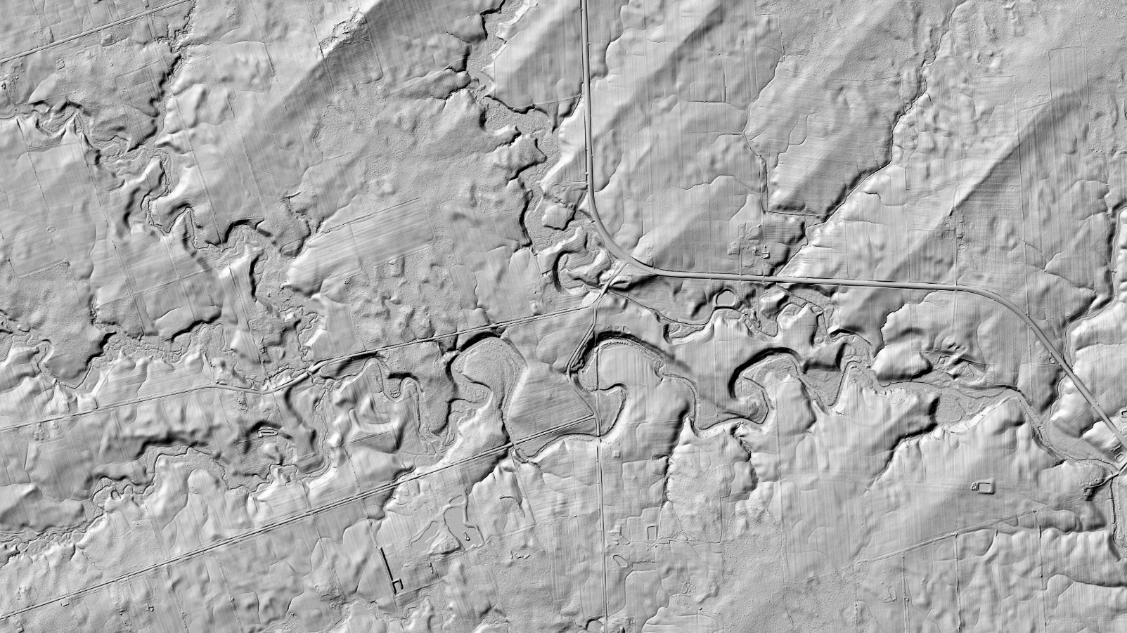
Over 186,000 km2 of LiDAR-derived elevation data are released on Open Maps to complement the HRDEM and HRDEM Mosaic products. In terms of area covered, this is the largest release of LiDAR-derived data to date by NRCan!
This new data is located in the provinces of British Columbia, Alberta, Saskatchewan, Manitoba, Ontario, Quebec, Nova Scotia and Newfoundland and Labrador. The total coverage of LiDAR-derived HRDEM and HRDEM Mosaic data now reaches nearly 800,000 km2 and covers 91 of the 100 largest Canadian cities.
With this new data release, over 34 million Canadians – 89% of the population – lives within the region covered by the HRDEM and HRDEM Mosaic products.
The LiDAR data used comes from numerous government organizations across the country, as well as from acquisition projects performed by NRCan.
All of this highly detailed 3D information provides essential foundational geospatial data for many government projects and priorities, such as flood mapping, forest inventories, climate change monitoring, and urban management. For more information on the HRDEM product, consult the product specifications or the download procedure. The HRDEM Mosaic product specifications are available here.
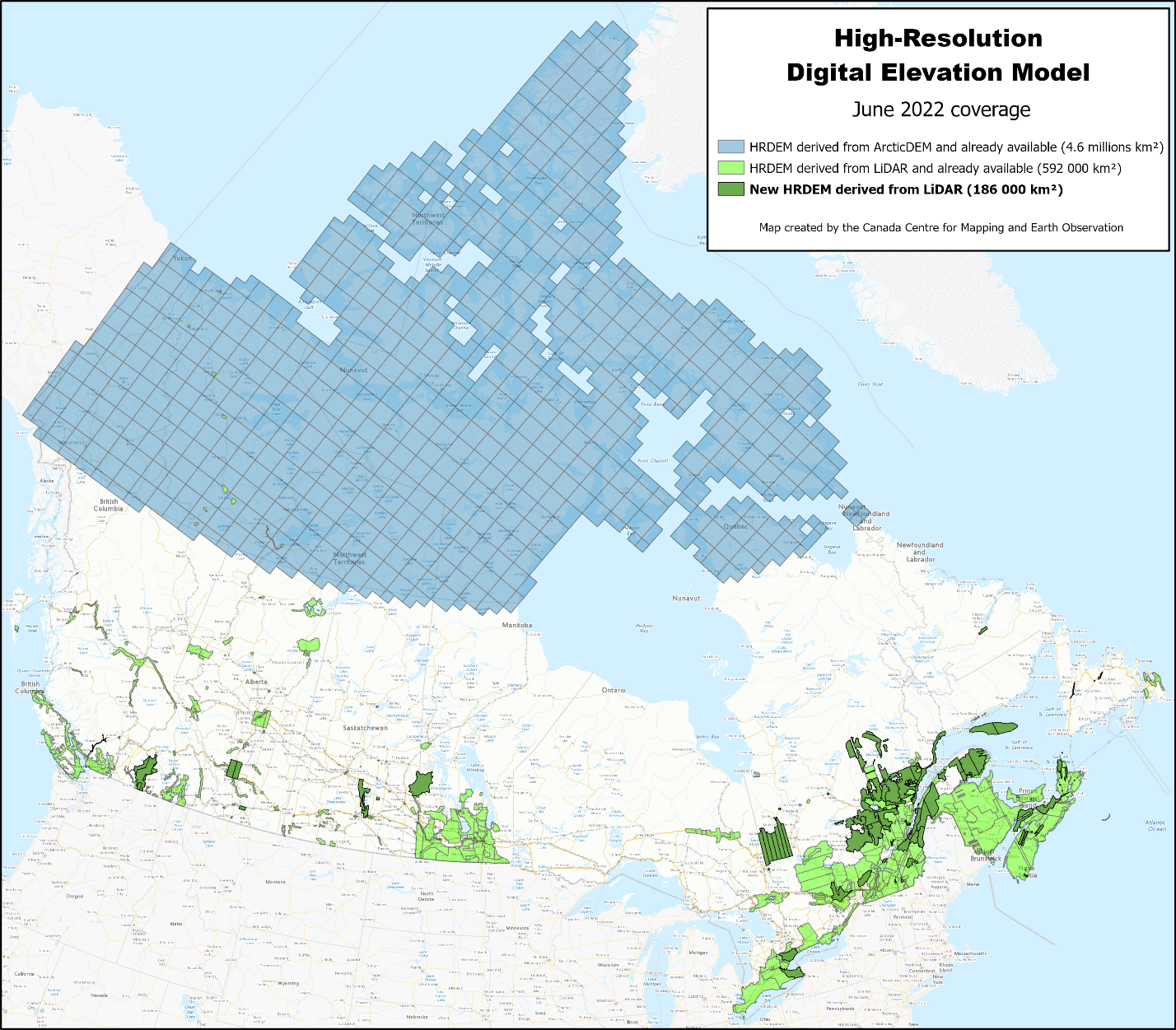
Legend: HRDEM product coverage in June 2022
Additions to Automatically Extracted Buildings
New LiDAR-derived building footprints have been added to Automatically Extracted Buildings product for Niagara-Hamilton (Ontario) and Last Mountain Lake (Saskatchewan) thanks to two newly acquired data projects by NRCan. These footprints are automatically extracted from building classifications in the LiDAR data. They contain information such as elevation and minimum and maximum building heights. The data is available either by download or through a Web Map Service.
Enhancing the National Elevation Data Strategy
The National Elevation Data Strategy, implemented by NRCan, aims to increase high-resolution elevation data coverage for Canada, standardize LiDAR acquisitions across the country and improve product accessibility. The HRDEM and HRDEM Mosaic products are part of the CanElevation Series created in support of the National Elevation Data Strategy. Collaboration with various partners is a key factor in the success of the Strategy, both to release existing data and to acquire new LiDAR data across the country.
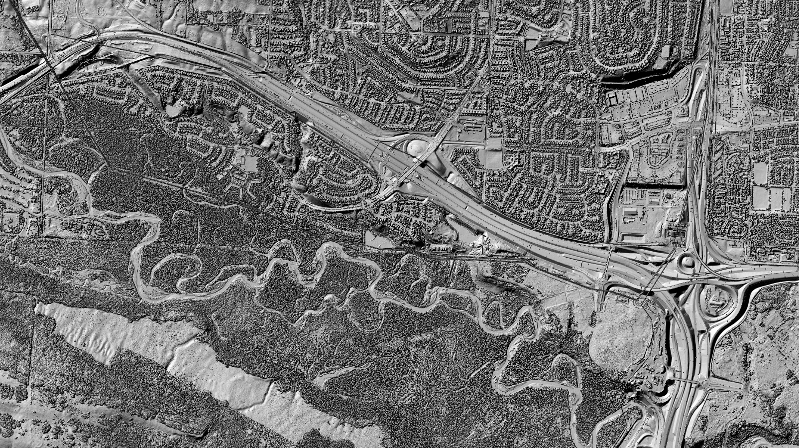
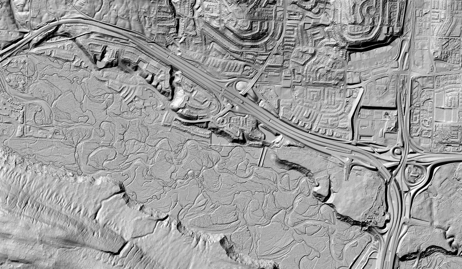
Legend: Shaded 3D reliefs of the Digital Surface Model (top image) and the Digital Terrain Model (bottom image) covering an area of the City of Calgary, AB.
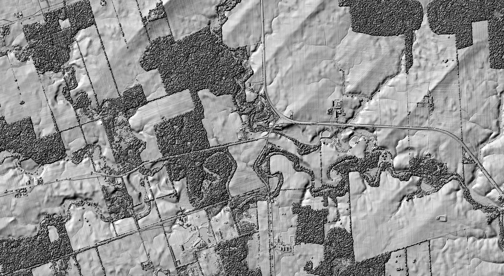
Legend: Shaded 3D reliefs of the Digital Surface Model (top image) and the Digital Terrain Model (bottom image) covering a part of the Niagara and Hamilton region, ON.
Page details
- Date modified: