
New LiDAR Point Clouds product: Canada as you've never seen it before!
Natural Resources Canada (NRCan) is pleased to announce the release of a new product called LiDAR Point Clouds. The product is a part of the CanElevation Series created to support the National Elevation Data Strategy led by NRCan and distributed under the Open Government Licence.
This new dataset currently contains the entirety of all LiDAR point cloud datasets acquired so far by NRCan, covering an area close to 60,000 km2. Coverage will increase as new LiDAR acquisitions are completed. LiDAR point clouds acquired by provincial, territorial and municipal partners may also be integrated into the product in the future and may already be available on their respective open data portals.

Various LiDAR point clouds showing buildings, energy infrastructure, a bridge and vegetation.
What is a LiDAR point cloud?
LiDAR point clouds are a form of data collected by LiDAR instruments, often installed on an aircraft. In a LiDAR point cloud, each point represents the exact location where the laser pulse launched by the LiDAR sensor is reflected off a feature on the ground’s surface. These points are usually accurate to around 10 cm. This highly detailed data can enable advanced analyses in areas such as flood mapping, forest inventories, urban infrastructure management, and beyond.
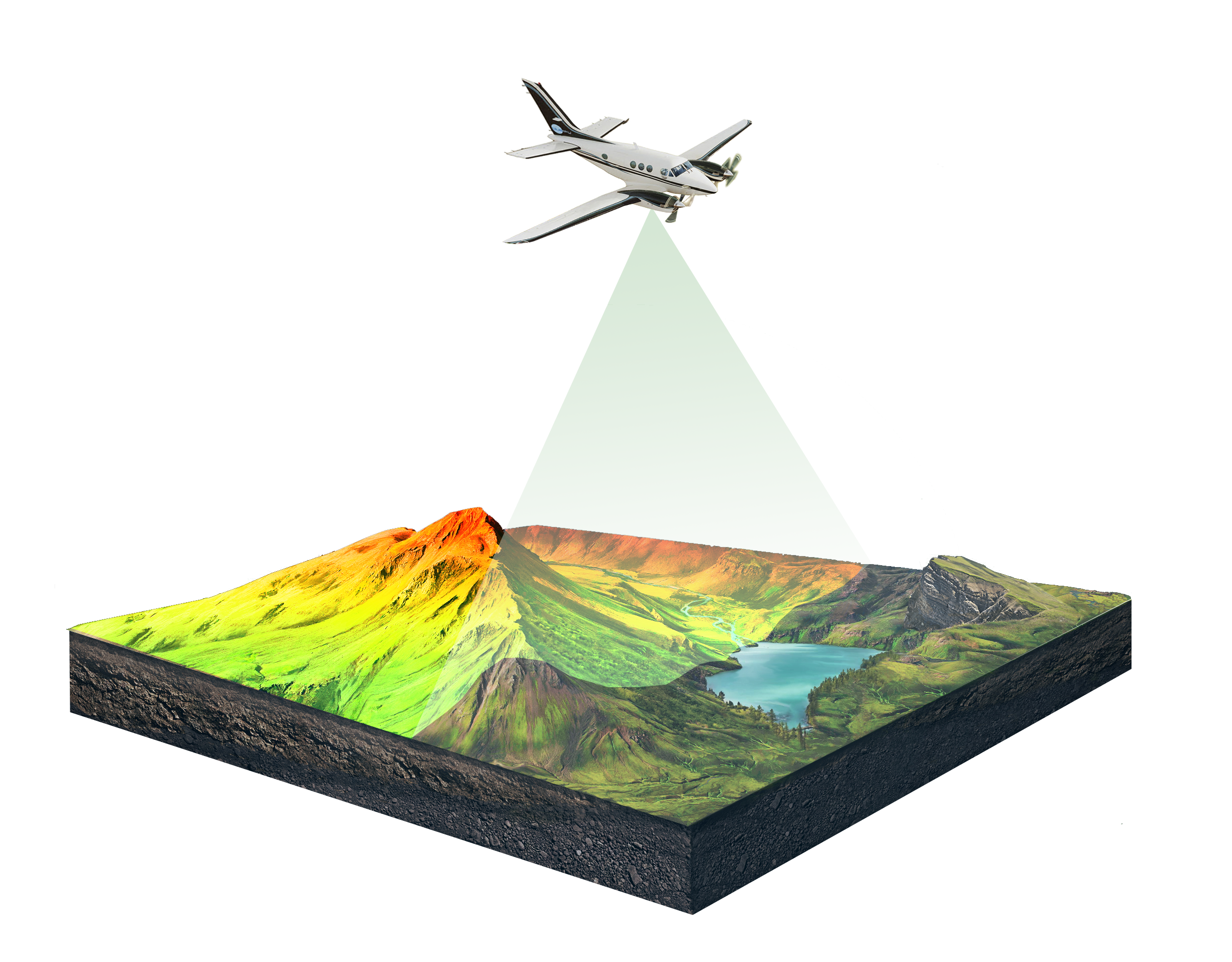
Diagram of an airborne LiDAR acquisition
A LiDAR point cloud, which is made of millions of points, contains information (including X, Y and Z elevation) for every single point. The points can provide an understanding of the ground’s surface, buildings walls and roofs, infrastructures, tree branches and leaves, and even noise from the atmosphere. LiDAR technology can penetrate the tree canopy, so many points will also represent the ground surface below the canopy.
Depending on the LiDAR acquisition specifications, atmospheric conditions, surface conditions (ex. with or without leaves on the trees) and the area covered, the content and characteristics of the information contained in the point clouds may differ between projects.
Explore the product
Data can be downloaded for local use using the product web service available on Canada Open Maps and GeoDiscovery.
The URL links of each point clouds file can also be read, visualized, and used directly in software that has Cloud Optimized Point Cloud (COPC) file capabilities (Ex. QGIS v3.26 and more recent).
See the product specification (PDF) for more details.
Cloud Optimized Point Cloud format
All LiDAR point clouds in the product are distributed in a compressed .LAZ / Cloud Optimized Point Cloud (COPC) format. The new open COPC format is a reorganization of the data within a .LAZ 1.4 file, allowing for more efficient use and rendering of visualizations via HTTP calls (e.g., via the web), while providing the capabilities of the compressed .LAZ format that is already well established in the industry. The point cloud files are therefore downloadable for local use as well as viewable directly via URL links from a cloud environment.
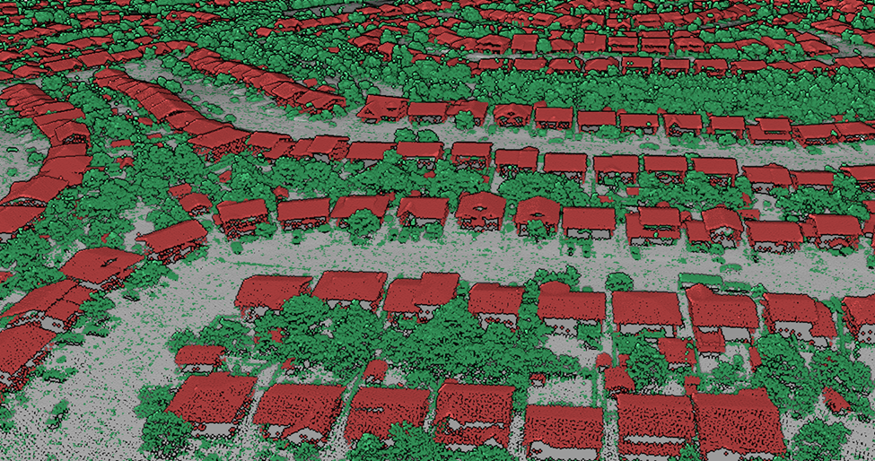
A 3D view of LiDAR point clouds from above a neighbourhood of houses and trees. Points corresponding to buildings, trees and the ground were colorized as red, green and gray, respectively.
Page details
- Date modified: