
NRCan's Role in the RADARSAT Constellation Mission
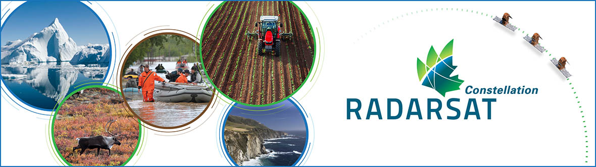
Spearheaded by the Canadian Space Agency (CSA), the Government of Canada’s (GC’s) RADARSAT Constellation Mission (RCM) builds on decades of Natural Resources Canada (NRCan) research, innovation, and expertise in Earth observations (EO), remote sensing, satellite ground station operations and big geospatial data management.
Find out how NRCan is supporting the RCM in this video:
Transcript:
Every day, the Government of Canada uses radar satellites to monitor Canada’s waterways, natural and human made hazards and to assess the effects of climate change and resource development on the environment.
Radar satellites have the unique ability to create images of the Earth’s surface at night or during cloudy weather — an ideal tool for a large polar nation such as Canada. Ground stations across the country control, collect and distribute the data.
Radar imaging isn’t new. In the 1970s, Natural Resources Canada scientists experimented with radar for Earth observation by mounting sensors on aircraft.
Since then, our scientists and satellite ground stations have supported the development and operation of Canada’s first Earth observation satellite, RADARSAT-1, which was launched in 1995.
It was replaced in 2007 by the RADARSAT-2 satellite, which is still operational.
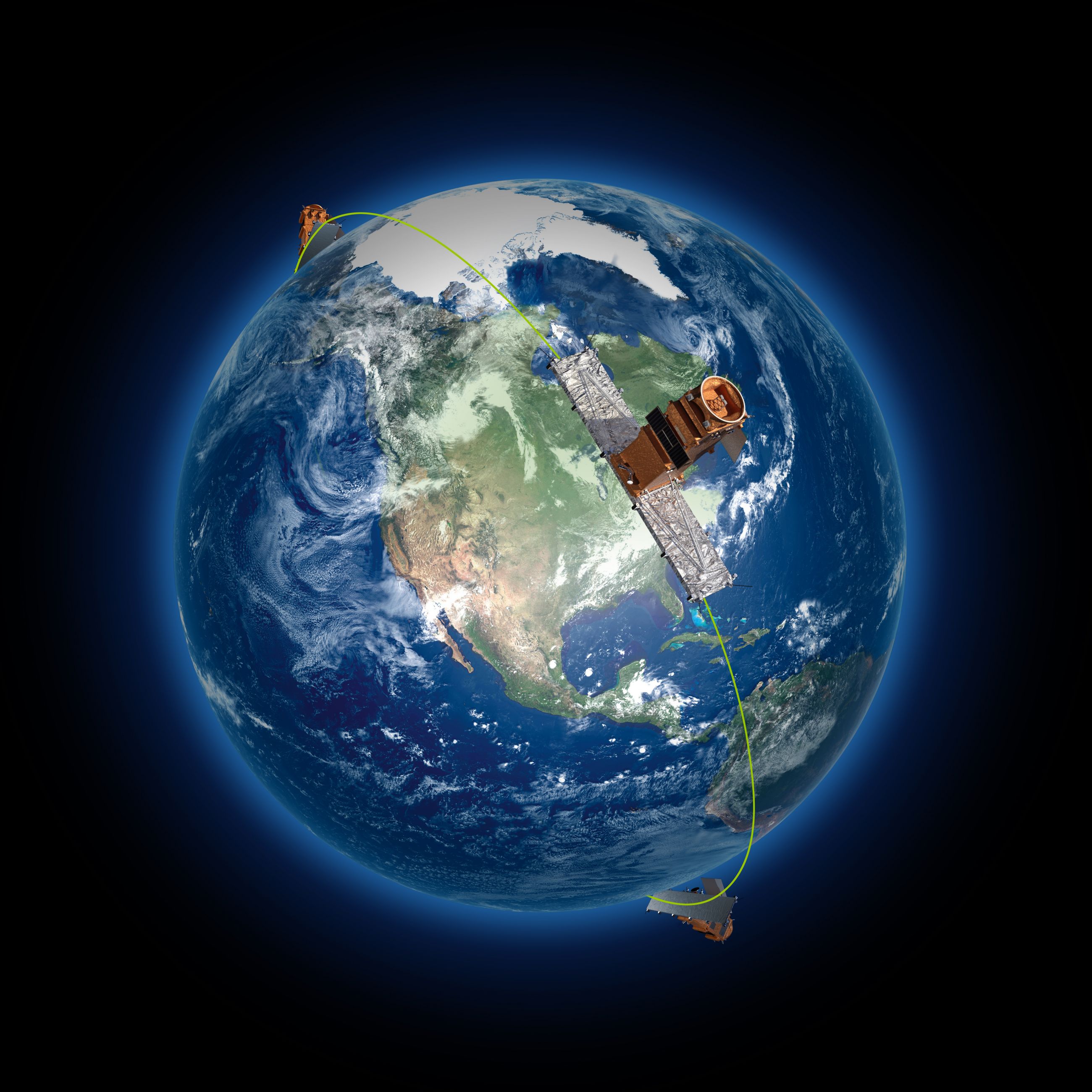
Today, Natural Resources Canada is proud to partner with the Canadian Space Agency and other government departments on the RADARSAT Constellation Mission. The mission will launch and operate Canada’s next generation of radar satellite: a constellation of three smaller satellites.
The RADARSAT Constellation is actually three identical satellites that share monitoring duties, allowing us to image the same precise location more frequently.
These new satellites will allow us, for the first time, to capture images anywhere in Canada on a daily basis, ensuring that the Government of Canada continues to have the data it needs to support critical operations and research.
Natural Resources Canada’s science and technology have led to the addition of a new imaging mode called Compact Polarimetry to the RCM.
This new mode enables users to gather better, richer information over larger areas than previous RADARSAT missions.
Natural Resource Canada has also made sure that government, industry and academic users will be ready to make use of RADARSAT Constellation data.
Our scientists created software that allowed users to practise using RADARSAT-2 imagery. Using these tools, users could refine and enhance their systems as needed in advance of the launch, so they would be ready to use RADARSAT Constellation data as soon as possible.
We also upgraded our satellite ground stations to be prepared to receive much higher volumes of data and to support ground-to-satellite communications for the satellite launch, imaging activities and satellite maintenance.
We also improved users’ access to data by expanding our radar data archives and developed a portal through which users can access RADARSAT Constellation data and — for the first time — request pre-processed radar images that will be easier to interpret and use.
Natural Resources Canada’s contributions to the RADARSAT Constellation Mission build on Canada’s long legacy of leadership in using radar for Earth observation and help to ensure that this vital technology continues to provide critical information that serves Canadians every day.
Radar Remote Sensing Science
Copyright Canadian Space Agency
Since 1972, the Canada Centre for Remote Sensing (CCRS) has played a critical role in advancing satellite-based radar remote sensing, first through experimentation with radar sensors on planes, and then as a critical partner supporting Canadian EO satellite missions, RADARSAT-1 (1995–2013) and RADARSAT-2 (2007–present).
Working with GC partners, CCRS scientists have contributed to the RCM by:
- Introducing and evaluating new imaging modes, i.e. compact polarimetry,
- building a data simulator so users can test proxy RCM data in applications before satellite launch,
- developing world-class calibration methods,
- building new systems that pre-process RCM data making it easier for users to extract relevant information from the expected large volumes of satellite data, and
- advancing the use of radar data to monitor permafrost, critical infrastructure, water, wetlands, and natural hazards (e.g. floods, earthquakes, landslides).
Canada’s Satellite Ground Segment
Starting with a single ground station in Prince Albert, Saskatchewan in 1972, NRCan’s Canadian Geospatial Data Infrastructure (CGDI) Division manages operations at Canada’s network of three satellite ground station facilities, which receive, manage and store the huge volumes of radar data collected from RADARSAT and other satellites. These NRCan stations also transmit commands to the satellites to control and task them. This important NRCan network will be responsible for acquiring and distributing RCM data to downstream users within and outside the federal government.
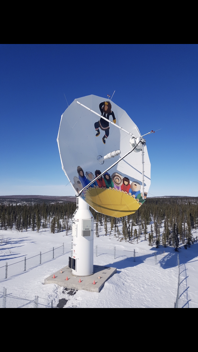
This new three-satellite constellation is expected to collect 50 times more data than Canada’s first mission, RADARSAT-1. To prepare for this new huge data stream, CGDI led significant upgrades to all three-ground stations in Inuvik, NWT, Prince Albert, SK and Gatineau, QC, and created a robust Earth Observation Data Management System (EODMS) for Canadians to discover and download RADARSAT and other EO data.
CGDI will also play a critical role in providing satellite launch support for RCM, tracking and supporting the satellites in the low earth orbit phase (LEOP) – one of the most critical phases of the mission, which can take 7 to 10 days.
Data Collections
Canadian Space Agency (CSA) Satellite Imagery Order Desk
Earth Observation Data Management System (EODMS)
Long Term Satellite Data Records (LTSDRs)
RCM-Simulated Products
RADARSAT Constellation Mission Publications
GEOSCAN Publications Searches:
Compact Polarimetry
RADARSAT Constellation Mission
Find out more
Page details
- Date modified: