
The Impacts of Climate Change on Northern Infrastructure (Ask NRCan)
In this episode of AskNRCan, we talk to research scientist Peter Morse about climate change geoscience and permafrost research in the North.
Transcript
Host: Welcome everyone to Ask NRCan. We have a really interesting episode for you today. We’re going to be talking about climate change geoscience.
Now, before we begin, for those of you who are new to this podcast, what we do on this show is we discuss a topic related to the work that we do here at Natural Resources Canada (or NRCan, because we’re the Government of Canada, and we love our acronyms). We introduce a topic, we discuss it with one of our NRCan experts, and then we look to you to continue the conversation over social media.
At the end of the episode, if you have any questions for us on today’s topic, we want you to go on Twitter and tweet at us using the hashtag, #AskNRCan. Our expert will do his or her best to answer all relevant questions.
Sounds good? Okay, let’s get started.
Host: Joining us today in our lavish Ask NRCan studio is research scientist Peter Morse. Peter, how are you?
Peter Morse: I’m fine, how are you doing today?
Host: I’m great. Okay, let’s jump into it. Let’s start with the basics. What is climate change geoscience?
Peter Morse: Well, it’s geoscience. We’re studying the earth in many different components. The reason why we’re doing this is in terms of the climate change geoscience program is that natural resource development in northern coastal areas, they’re vulnerable to climate change. Another problem there is that there’s relatively limited information about those landscapes and those settings. If you’re going to have natural resource development and have it be sustainable, we need improved geoscience information.
Host: I see. So, here at Natural Resources Canada, you and your colleagues — what’s your role? What do you do in terms of climate change geoscience?
Peter Morse: Day to day, as a research scientist, I plan out research activities to address some of the knowledge gaps that we have. I’m working within a project that is called “Supporting Adaptation in Permafrost Regions.” This project has three main components. One is to improve the Canadian permafrost map. The map that we have right now is a very broad scale. It’s not that useful for detailed work, so we’re working at improving the permafrost map. That’s taking advantage of much better data sets now, improved modelling approaches and that sort of thing.
Host: What exactly is permafrost, for those of us who are not familiar?
Peter Morse: Permafrost is just a temperature condition of the ground. It means that the ground stays at or below zero degrees Celsius for two or more years. That’s the general definition.
What’s interesting about permafrost though is, because it’s below zero, if there’s water in the ground, it’s actually ice. And so, in many places, particularly in the western Canadian Arctic, there’s actually a lot of ice in the ground in this permafrost. You might contrast that with a place like the North Slave region, north of Yellowknife. If you picture the Canadian shield, you can have permafrost there. But it’s primarily in rock, and so any infrastructure that you build there, it’ll be relatively stable, no matter what the climate conditions are.
But relatively speaking, if you’re building infrastructure to support communities or industrial development or whatever, and you build it over permafrost that has a lot of ice in it, you can get into problems. This is what I’m interested in. What are the permafrost conditions that could be a problem? Because if you know where problem areas are, then you can start making better informed decisions about adaptation and trying to develop more resilient infrastructure.
Host: When you build a building or road on top of permafrost, how does that impact the permafrost? Does it warm it up? Does it affect it differently? Are you worried about something like an external factor like climate change affecting the permafrost, and then it affects the structure?
Peter Morse: That’s a good question. Permafrost is there broadly because of climate, because of cold air temperatures all year round — really cold winter air temperatures and basically cooler summer air temperatures. So the farther north you go, the more widespread permafrost is. So, if you have climate warming or time-over-time gradual warming, then permafrost temperatures increase.
So right now, in the western Canadian Arctic, air temperatures are warming. In terms of the rate that air temperatures are warming there compared to the global average warming, it’s actually an even higher rate. They’re warming quickly in the western Arctic.
The landscape there, the permafrost there, is responding already. We see increased activity in things that we call retrogressive thaw slumps. It looks like a landslide — it’s not — but it looks like it. And it’s basically because you are thawing permafrost that has a lot of ice in it, so you start having materials moving around there. So there is this background of climate change, and it is affecting permafrost conditions.
But on top of that, there’s a brand new 120 km highway that’s just been built; well, it’ll be finished mid-November, so it’ll probably be finished by the time this goes to air. It’s a brand new 120 km highway, and it goes from Inuvik to Tuktoyaktuk on the Beaufort Sea.
Host: And you were involved in that process? Were you just studying the grounds?
Peter Morse: Well, this goes back to your question of what happens when you build on permafrost. Against this background of climate change, you now have a road that’s been built on top of permafrost. And so putting anything on top of permafrost changes the relation between the cold air — air temperatures — and permafrost, because again, you have a cold climate, that’s why you have permafrost.
So, anything that changes that relation, whether you put a road on top of the ground or snow depth increases everywhere by 50 cm. But anyway, anytime you change that, you’re going to change permafrost temperatures. And that’s important, because if the permafrost is close to zero, and putting a road on it or something like that causes ground temperatures to increase, and you start thawing permafrost, and if the permafrost has a lot of ice in it, the road won’t be very stable.
My job — well, I’m not an engineer. I wasn’t involved in the construction of the highway at all, but what I am interested in is the overall how the landscape in the region will change. I’d like to be able to produce information that can help decision makers, planners and engineers improve existing infrastructure and anything new. This is the highway that’s just been built, and we can well imagine in the future there will be possibly spur roads here and there for who knows what kind of development of activities. This is a big way to open up that part of the world.
Host: This is really interesting research. So in this situation with your work on the road, did you learn something specific? Did you get any new information that can be used for future infrastructure projects in the North or in the regions?
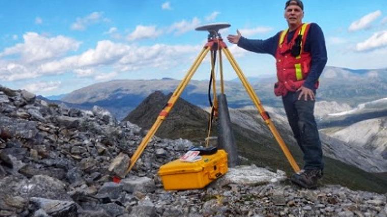
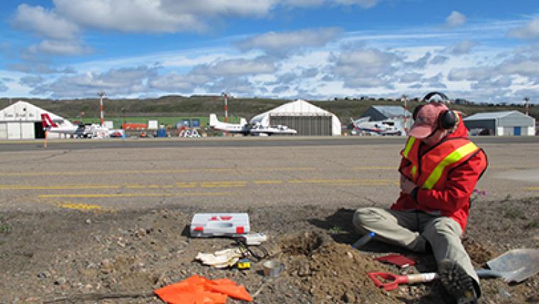
Peter Morse: The project officially started last spring. So the project I’m working very, very closely in collaboration with is the Northwest Territories Geological Survey, and I kind of think this is as almost a partner project. And one of the first things we got support for doing was to drill a number of bore holes. It’s literally drilling a hole in the ground to sample permafrost, and the hole in the ground is about six inches in diameter. We got 16 bore holes, and we retrieved about 190 metres of permafrost. The great thing from my perspective on these is that we were able to literally take a tile saw, cut these cores in half, and we can archive half of them for other work.
Meanwhile, we took the other half, and we’re doing all kinds of stuff with them to learn about the different materials, the amount of ice, the water chemistry, all of these things. There are still results coming back from the lab. What we did see was a huge variety of different surficial materials. Those were the materials laid down on the ground surface, and within those, lots of variation in the ground ice content.
We’re interested in this, again, because broadly, if this landscape starts to warm up, permafrost thaws, and ice melts, there are implications for the highway. But, when this permafrost melts, there will be changes in water chemistry as the water runs off the land. Those changes in chemistry will relate directly to the chemistry of the ice and the permafrost. By learning as much as we can about the permafrost conditions, we can then work with ecologists, biologists et cetera to help them figure out what are the other effects that permafrost degradation or permafrost thaw might have in these regions.
These bore holes really will be a keystone dataset in this region. There are hundreds, if not thousands, of other bore holes that have been drilled in this region, which is amazing. But they’ve been drilled to support oil and gas exploration when they were proposing to develop the Mackenzie Valley gas pipeline. So there is lots of data that’s been put together, but not in this much detail. And so we want to use these bore holes that we’ve worked on to tie in everything else.
The other thing that we’re doing with these is once you have a hole, we put a whole bunch of thermometers down the hole to measure temperatures. Because that’s the other component of permafrost. It doesn’t matter how much ice you have in it — if it’s cold, it’s cold. But if the ground temperatures are changing and they are increasing and the permafrost is getting close to thawing — that’s what we’re very interested in. So all of these holes have been instrumented to measure ground temperatures.
Host: It’s not just about the existing permafrost, but it’s about the behaviour as well?
Peter Morse: That’s exactly it. If we step back again — and I’m going to talk about the western Arctic because it is near and dear to my heart — it is a very dynamic landscape that has been shaped by several past processes. A long, long time ago it was a delta. It was at the edge of the last continental glaciation. There’s artifacts and effects from that legacy. There’s been deglaciation. Permafrost has grown. There are all different kinds of landscape-shaping processes that have gone on over time. It’s this dynamic environment that is still changing.
But the way it will change is primarily a function of the permafrost temperatures and the ground ice content. So, in terms of generating new geoscience knowledge, that’s my focus. Because it can inform many other people doing research and making decisions on how to develop sustainable infrastructure to support communities and industry.
Host: Seems like it’s very interesting and important research. I want to go off on this last question, not specifically about what you do but what your colleagues do as well. For climate change geoscience, do you do something beyond permafrost as well?
Peter Morse: Absolutely. We’re talking about climate change, so changing temperature, changing precipitations; so snow versus rainfall; and then in the Arctic, of course, there’s changing sea ice patterns. So all the activities we’ve been working on and all the projects we’ve developed within the climate change program address many of those different subjects.
There’s another project which is the supporting adaptation in coastal regions, and within that there is an activity that looks at sea level projections. If you have a rising sea level, and there are a number of reasons why at a specific coastline or shoreline that the sea level is rising — so we want to know why. Because if you live at the coast and the shoreline is eroding, and you have property, or your town hall, or your port or whatever is getting filled with sediment — there’s lots of reasons why you would want to know about sea level rise. And then, the coastal dynamics there: what are the feedbacks between rates of erosion and relative sea level rise, and that sort of thing.
Ultimately, there’s always the big picture component, and so there’s CanCoast Indices. And that’s trying to develop this national database of the relative rates of coastal retreat. And basically it will point out a lot of the really problematic areas in the Canadian coast.
A third project within this iteration — I can’t believe I said iteration — in this version of the climate change geoscience program is looking at extreme events. It’s basically adapting or advancing climate adaptation through improving drought indices and better improved flood forecasts. One of those activities focuses on flood forecasting in Hudson Bay lowlands. And then there’s also an activity there to reconstruct the past hydro-climate in the central Labrador–Quebec peninsula area, and northern Manitoba. There are a number of activities we are undertaking within the Climate Change Geoscience Program.
I’m one of the permafrost researchers, but there are researchers from a number of different backgrounds. This is one of the neat things about the Climate Change Geoscience Program — how many different people from different backgrounds are working together to solve these problems.
I was thinking about a paper I was getting ready to submit, and that if I was writing it on my own, it wouldn’t be nearly as good without having worked with these internal collaborators. And another great thing about our Climate Change Geoscience Program is that we are encouraged to work with many outside collaborators, and it’s the same thing. The benefit we get from working with other people in other communities brings a lot of new ideas to inform our science. It also means that once we learn something, we’re able to share that information as broadly as possible. I don’t know how many people — besides researchers — sit down and read journal articles.
When I’m developing my career, it counts how many articles I have. But really, most people are interested in what we’re doing and how does it affect their lives. And so by working with our networks of people, we try hard to share our information as broadly as possible. And this is one way I’m doing it.
Host: There we go — and that’s the perfect way I think to end this interview. Peter, thank you for taking the time to demystify all of this for us.
Peter Morse: My absolute pleasure.
Host: Perfect. So, now’s the point of the episode where we ask you, the listeners, to continue the conversation with us over social media. If you have any questions for Peter, or if you have comments on the episode, we’d like you to get on Twitter and tweet at us using the hashtag, #AskNRCan
We also wanted to let you know that we’ve just launched Simply Science. It’s Natural Resources Canada new online scientific magazine. The focus of the magazine is to profile the science that we do here in the department, as well as the people who do it, like Peter.
We’ll be using videos, podcasts like this one and articles to make our science engaging and accessible to everyone.
We don’t have the specific URL at the time that we’re recording this, but I’m sure you can find Simply Science on our website at www.nrcan.gc.ca or on our Twitter page @NRCan. You might want to check out Simply Science as well because we’ll have a podcast article up specifically on climate change geoscience, and we’ll link to any interesting material or any relevant material so you can do your research and send in your questions.
Well, I think that’s it for today. Thank you for listening. If you’re listening to us on iTunes, please consider subscribing so you can check on any previous or future episodes.
We look forward to hearing from you, and we’ll see you next time.
Explore more on climate change geoscience


Related stories
Page details
- Date modified: