
Prototype flood map app captures what satellites can’t
By Amanda Burke
May 10, 2018
Picture the devastation of communities hit hard by flooding across Canada: drowned cars, damaged homes, financial ruin and lives forever changed. In every case, citizens and emergency workers fight tirelessly against the gushing water in the hardest-hit areas.
Crisis decision-making on a dime
When floodwaters come in fast and furious over large geographic areas, emergency responders and municipal governments need up-to-date information to make quick decisions. They need to know where to send emergency workers and troops, equipment and supplies; when and where to issue advisories, road closures and detours; whether to shut down or relocate services like hospitals and medical clinics; and whether to evacuate homes.
But how do they know where and how fast waters are rising? And how do they decide which buildings, bridges and roads are at greatest risk?
Near-real-time data
A team of scientists at Natural Resources Canada (NRCan) provides emergency responders and municipalities with data they need to make decisions. They collect the data from radar satellite images and produce near-real-time maps for emergency responders during crises such as floods. As geographer Vincent Decker explains: “Our job is to grab intelligence from the satellite image and make it talk on a map.”
Over the last decade, NRCan scientists including Decker`s team, have developed semi-automated radar satellite imagery interpretation and processing techniques that produce an outline of flooded areas on a map within four to six hours of receiving an image. This data can be overlaid in a Geographic Information System (GIS) on other satellite images taken before or after the flood for comparison, on top of other GIS data like road and hydro networks, or compared with air photos of flood conditions taken by a plane or a drone.
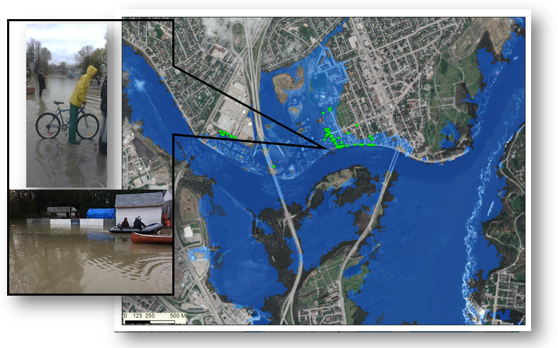
Larger image
Urban Flood Mapping Crowdsourced geographic information (CGI) Observations - Gatineau (2017-05-07) Flood Extent (RS2-20170507)
Although this technique provides a “best estimate” of flood conditions and is vital intelligence for situational awareness, it has its shortcomings.
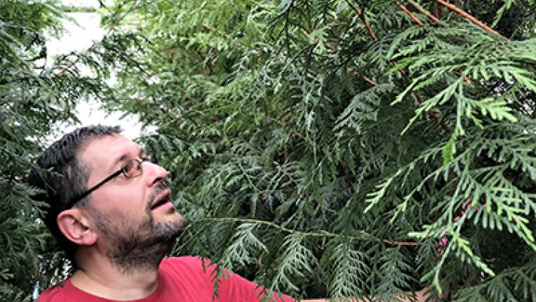
Radar sensors, which can easily “see” through cloud cover, have trouble getting an accurate picture of where floodwaters and land meet in built-up urban areas, under tree canopies, in flooded vegetation and in the mountains. Flood maps are also generated in high volume and at lightning speed, so there has been no time for verifying what`s on the ground during a flood crisis…until now.
Citizen scientists as supplementary sensors
Emergency responders are currently testing a new prototype app developed by Decker’s team. In the future, it could turn smart phone-toting Canadian citizens into supplementary sensors that could help validate and update flood maps.
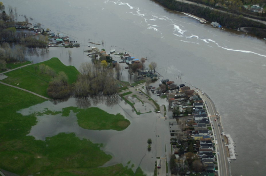
Larger image
Aerial flood photo courtesy of Transport Canada
App users on-the-scene – ideally at the water`s edge – receive a notification from their phone of a radar satellite`s passage overhead. They snap a photo and complete a one-minute survey that describes the flood scene so the uploaded photo and data are linked in time and place to the satellite image. The app even knows which direction the camera was facing when the photo was taken.
Decker and his team are developing artificial intelligence (AI) processes that will filter and sort the photos, and identify the water-land boundary, homes, roads and other details that are difficult to capture using radar. Through AI, they will also be able to sort photos to remove people`s faces for the purpose of safeguarding privacy and eliminating any inappropriate content. All this could save hundreds of hours of work.
When the app goes beyond the prototype stage, it will have the potential to generate thousands of photos that could help validate and improve the accuracy of future flood maps.
More data, more often
The app is part of the team’s ongoing research to develop innovative methods and tools to improve the usability and application of satellite data and imagery to a wide range of real-world problems, including flood mapping and river ice monitoring.
Emergency mapping will get another boost this fall with the launch of Canada’s next generation radar satellites as part of the RADARSAT Constellation Mission (RCM). Once launched, the mission’s three satellites will fly in the same orbit 32 minutes apart. This arrangement will dramatically reduce the time it currently takes to obtain a satellite image of the same exact location on the globe from every 24 days to every 4 days. It will also provide a view of the same location from a slightly different perspective daily.
“The RADARSAT Mission will create a massive amount of new data to support emergency response in Canada,” says Decker. . This will improve the production frequency and accuracy of the flood maps required by emergency responders when the water is rising.
Related stories
Page details
- Date modified: