
Footprint meets hoofprint: measuring a mine’s effects on caribou
Both traditional knowledge and scientific studies have observed that barren-ground caribou are very sensitive to changes in their environment. Disturbances can interrupt feeding, for example, or cause the caribou to move away, using valuable energy needed for growth, health and reproduction.
Caribou stress
In the last 40 years, the size of the Bathurst caribou herd, whose range covers parts of Nunavut, the Northwest Territories and Saskatchewan, is estimated to have dropped from about 450,000 to 20,000. Researchers are looking at changes in the herd’s environment to better understand contributing factors. Possible stressors include habitat quality, climate change, predation, harvest size and forest fires. Among man-made, causes, disturbances from mining operations, such as noise and dust, may also play a role.
Larger image
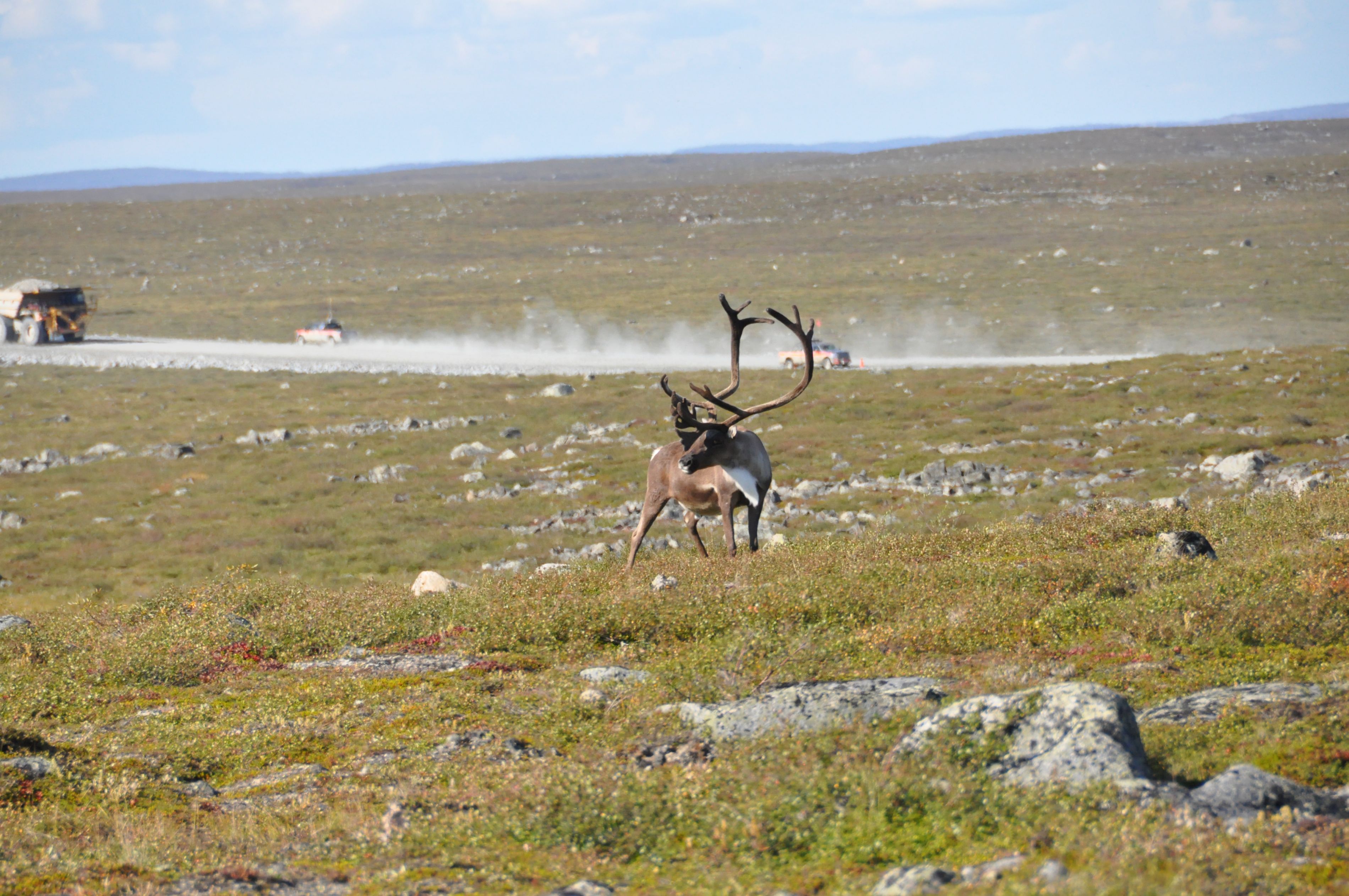
A caribou spotted near a haul road of the Ekati Diamond Mine, Northwest Territories (Photo by Wenjun Chen).
A mine’s environmental footprint
Traditional knowledge and scientific research have each reported that caribou tend to avoid areas such as mine sites. Based at the Ek’atì (Lac de Gras) diamond mine site and surrounding area in NWT, a research team led by Dr. Wenjun Chen of Natural Resources Canada has been conducting field surveys, satellite remote sensing and laboratory analyses to learn more about the size of a mining development’s footprint.
“We’re providing the objective evidence required for informed decisions,” says Wenjun. “Others can then consider the impact of mines on the recovery of the herd, as well as how to mitigate any impact.”
Measuring mining-related dust and its potential effects on caribou food — lichens and plants — is one focus of the research.
Gathering dust
Community members have often noted dust on caribou food. Dust consists of bits of dirt and other tiny solid particles scattered or suspended in the air, stirred up by passing vehicles or carried by wind. Large particles fall out of the air almost right away, close to the source, while finer particles remain in the air longer and fall farther away.
In conducting their research, Wenjun and his team first determined that the dust they measured did not come from sources other than mining activities, such as rocks. They picked leaves, washed them and then measured the turbidity — or cloudiness — of the water, creating a “dust map” that could be read and measured. They also measured the amount of dust on leaves using hyperspectral remote sensing imagery, which detects even subtle colour changes. Their results were clear: the amount of dust on birch leaves collected within 1 km of the mine’s Misery Road site was two to eight times higher than the background value.
Larger image
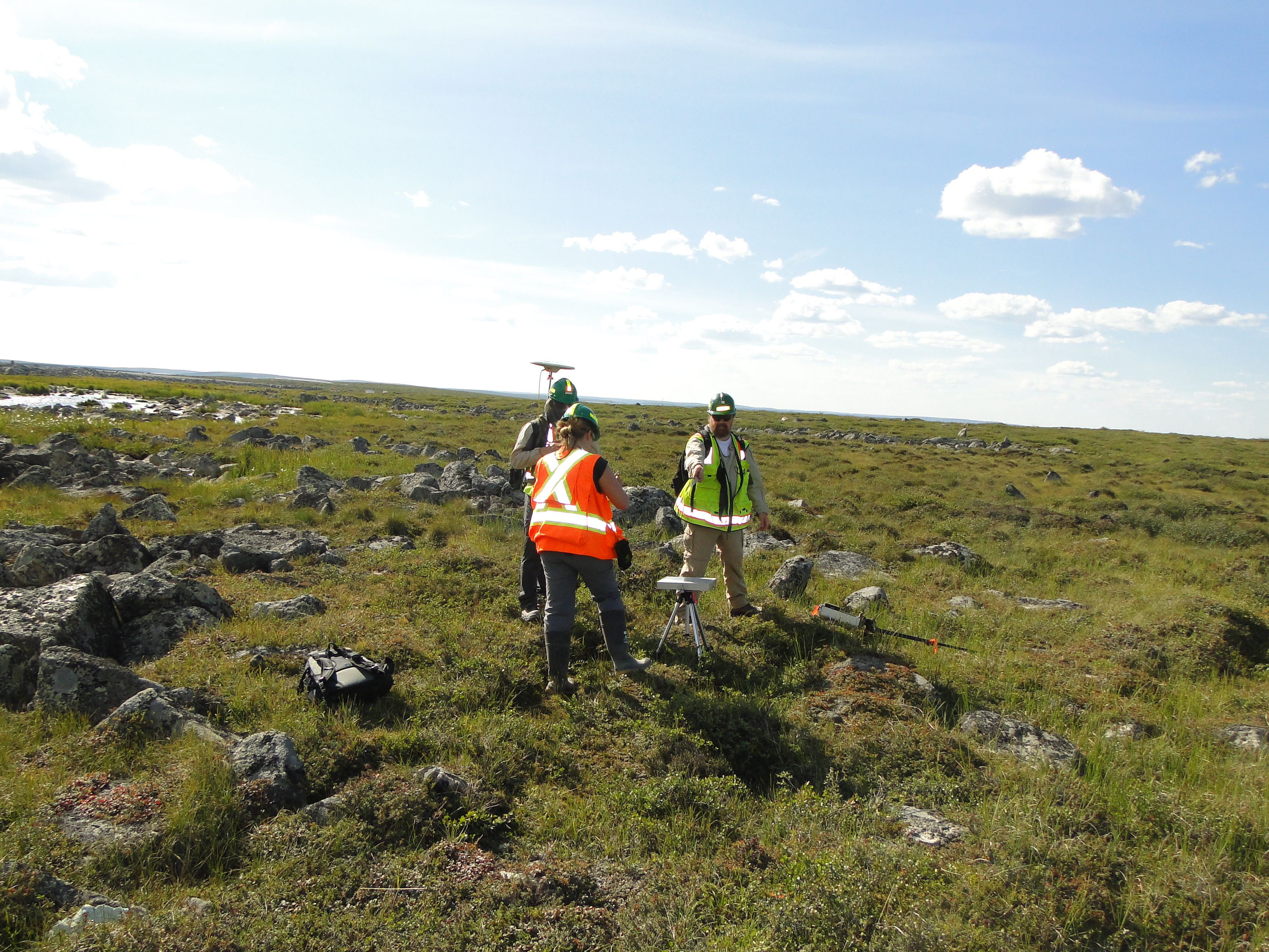
Researchers collecting plant and soil samples, measuring the hyperspectral reflectance of the vegetation, and recording precise GPS positions near the Ekati Diamond Mine (Photo by Wenjun Chen).
How dust affects soil and vegetation
Another way to detect dust is by considering the pH — the acidity or alkalinity — of soil, since dust tends to make soil more alkaline. The research team found that soil pH changed significantly near the busy mining road but was hardly affected near a road that was not well used.
Soil pH affects plant life and thus caribou diet, with some plants — such as blueberries and lichens — preferring acidic conditions and others requiring higher alkaline levels.
Lichen
Lichen is an important part of the caribou’s diet, and it is especially sensitive to air and soil pollution. Using both remote sensing and visual surveys on the ground, the research team measured the amount of foliage and the height of various types of vegetation at different distances from the Misery Road site. To study the effect of dust on lichens, they calculated the percentage of land covered by lichen at different locations. When they graphed the results, they saw less lichen close to the road. So, in the case of lichen, these initial observations indicated that the effects of dust reached about as far as 1 km from the mine site.
Combining these results with their measurements of soil pH at different distances from the mine, the team then graphed the relationship between soil pH and lichen cover. Their preliminary findings showed that lichens were most abundant when the soil was slightly acidic and completely absent when the soil was highly alkaline.
Vascular plants
The team also looked at plants such as trees, shrubs, grasses and flowering plants at different distances from the Misery Road site and found the relationship to soil pH very similar to that for lichen. As vascular plants, this group uses roots and stems to take in water and nutrients. As was the case with lichen, vascular plants were few close to the road but increasingly common farther away. However, vascular plants were found much closer to the road, suggesting that they may be more resilient to dust than lichens.
Next steps
“My hope for future phases is to see if what we’ve been monitoring helps to explain why caribou are declining,” says Wenjun. “This is meaningful work .... It feels good to do work that could have an impact on the economy and local people.”
This story has been condensed and adapted from an article by Susan Beaumont, Wek’èezhìı Renewable Resources Board.
Related stories


Page details
- Date modified: